PUNTLEDGE LANDS
Where two rivers meet,
a rural future is taking shape.
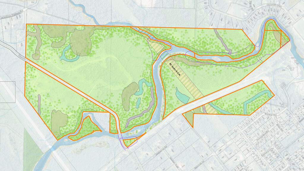
A new vision for 483 acres at the confluence of the Puntledge and Browns rivers — a protected network of waterways and wetlands set within a dynamic cluster of rural employment and recreation.
483
ACRES
2
PROTECTED
RIVERS
7
Land use clusters
A NEW VISION FOR PUNTLEDGE
Under new ownership, the 483-acre site at the confluence of the Puntledge and Browns Rivers is moving through the Comox Valley Regional District’s (CVRD) planning process. The proposal is to develop these lands in alignment with the CVRD’s Official Community Plan — as a rural employment area that protects the rivers, wetlands, and culturally significant areas across the site.
The site includes Stotan Falls, sensitive wetlands, and lands with deep K’ómoks First Nation (KFN) history.
THE LANDS
A place unlike anywhere else on Vancouver Island
Representing a significant 195.6 hectares (483 acres) at the edge of the City of Courtenay, bridging into the rural Comox Valley Regional District, these lands carry a rare combination of natural, cultural and scientific significance — and a community history of recreation stretching back over a century.
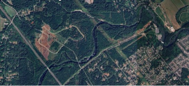
Two rivers, one unique site
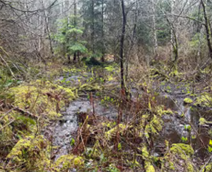
The Browns and Puntledge Rivers meet within these lands, with Stotan Falls — a long used community recreation site — located within the area. Sensitive wetlands line the rivers’ edges.
River Convergence
The Browns and Puntledge Rivers meet within the site.
Paleontology
Notable fossil deposits with extensive interest from the scientific community.
Stotan Falls
A treasured community recreation destination on the lands.
Sensitive Wetlands
Ecologically important wetlands run along the rivers.
K’ómoks Heritage
These river corridors have long been important to the cultural history of K’ómoks First Nation.
A Century of Recreation
Used by the CVRD community since the area’s settlement over a century ago.

Environmental Review
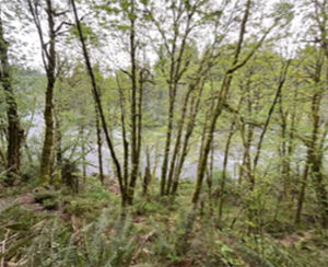
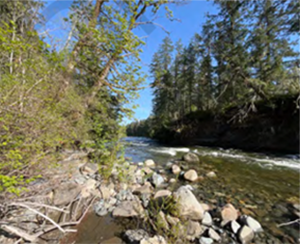
An independent environmental study completed in 2025 by Corvidae Environmental Consulting mapped the site’s ecosystems. Environmentally sensitive areas will be conserved and protected wherever possible and necessary.
The project team is also engaging with conservation organizations and other environmental stakeholders as planning progresses. Particular emphasis is being placed on protecting important environmental features and maintaining public access to valued recreational areas along the rivers.
K’ómoks First Nation & These Lands
These lands are within the traditional territory of the K’ómoks First Nation (KFN), who have used the area for thousands of years for hunting, fishing, gathering, and settlement. The site holds significant cultural and historical importance to KFN.
Engagement with KFN began early in the planning process, well before the rezoning application was prepared. Archaeological studies have been completed by In Situ Archaeology, KFN’s archaeological consultant. Engagement with KFN will continue through the rezoning, subdivision, and approval phases of the project.
PLAnning & POLICY
From OCP vision to proposed zoning.
The Comox Valley Regional District’s Official Community Plan (OCP) sets out a clear, long-term vision for these lands: a rural area supporting employment, resource activity, and community recreation, with sensitive environmental and cultural areas protected.
What’s proposed
The proposal is to create a network of rural-oriented businesses and employment areas, alongside community recreation and event opportunities, within a framework of protected rivers, wetlands, and ecosystem areas across the site. This direction aligns directly with the OCP. The OCP sets the high-level vision; the zoning sets the specific land uses that bring that vision to life.
Why rezoning is needed
The site is currently zoned Rural 20 (R-20), with a portion zoned Upland Resource (UR). These zones allow a narrow set of uses that don’t reflect the broader role the OCP envisions for these lands — supporting agriculture, rural industry, resource activity, cultural and recreational uses, and limited workforce housing. The rezoning application is the mechanism for bringing the site’s zoning into alignment with what the OCP already calls for.
Proposed land use clusters
The proposed zoning organizes permitted uses into clusters — groups of related activities that naturally benefit from being located near one another. Each cluster reflects a land use category supported by the OCP.
The clusters explored in the following sections include agriculture, equestrian, forestry, granular and concrete, rural industrial, institutional and cultural tourism, resort and recreation, and a limited amount of workforce housing to support the rural economy.
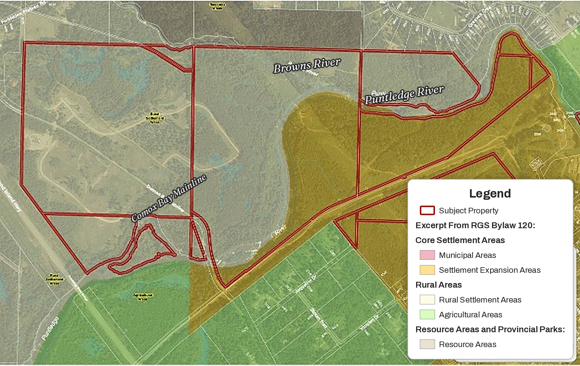
Zoning Map
Growth Containment Boundary
- The majority of the lands in this project are outside the Growth Containment Boundary (GCB) within the Regional Growth Strategy (RGS) and only lands south of the Puntledge River are in the future settlement expansion area.
- The proposed project does not involve any changes to the GCB.
Settlement Expansion Area
- The ochre brown coloured area on the map along the south edge of the Puntledge River is designated as a “Settlement Expansion Area.” This area is identified for future possible expansion of Courtenay in the future.
- Currently, the area is to remain low density and rural in nature in accordance with the RGS and OCP.
Rural Settlement Areas
- The grey/beige coloured areas on the map are designated as a “Rural Settlement Area.” The OCP vision for this area includes:
- To promote rural forms of land uses.
- To promote alternative and more affordable forms of low density housing.
- To keep larger rural land parcels.
- To minimize new large commercial developments to being part of housing, industrial and agricultural uses.
- To promote agricultural, industrial and other rural economic development, including agricultural operations, farm-gate sales, food processing establishments, food distribution centres, farmers markets and agricultural research facilities.
- To support industrial development including heavy and light industrial, agriculture, aquaculture, timber harvesting and milling, aggregate extraction and processing, and other rural resource activities.
- To support some institutional development – especially if connected to one of the other primary rural land uses.
THE VISION
A cluster of rural-oriented opportunity.
The vision is to create a dynamic cluster of rural businesses and employment, with community recreation and events, all set within a protected network of rivers, wetlands and diverse ecosystems — in alignment with the OCP.
CLUSTER 01
Agriculture
Agricultural uses are a cornerstone of many rural areas including this site with its supportive terrain and access to water.
- Greenhouses
- Field crops & horticulture
- Aquaculture
- Food processing
- Storage & distribution
- Farm-direct retail
- Brewery / distillery / winery
- Agritourism
- Food events & catering
- Research & education
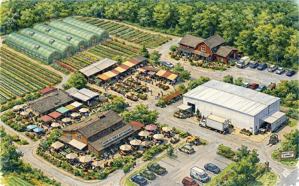
Rendering of agricultural cluster
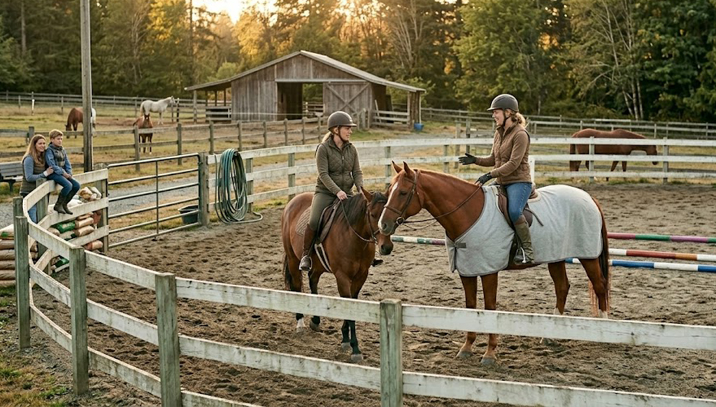
Equestrian demonstration
CLUSTER 02
Equestrian
Diverse facilities that need significant space and attractive topography, ideal close to urban areas.
- Stables, barns, hay storage
- Fields, corrals, training rings
- Feed & tack retail
- Indoor / outdoor event space
- Veterinary offices
- Trailer storage & repair
- Kennel
- RV park / hospitality support
CLUSTER 03
Institutional & Cultural Tourism
Appropriate in a rural area with the extensive cultural and paleontological resources of these lands.
- First Nations cultural uses
- Museum / protected areas
- Event & assembly space
- Paleontology research
- Educational uses
- Cultural tourism
- Minor onsite offices
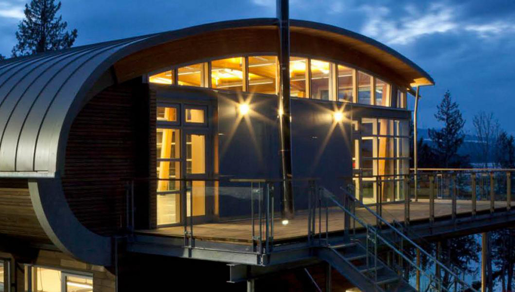
Deep Bay Research Station
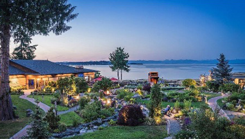
Kingfisher Resort
CLUSTER 04
Resort, Hospitality & Recreation
Opportunity noted in the OCP, given proximity to urban areas and two rivers.
- Tourist accommodation
- RV park / campground
- Recreation, various
- Event assembly space
- Boutique retail
- Art / culture gallery
- Health & wellness
- Food & beverage
CLUSTER 05
Forestry
Forestry and lumber industries supported in the OCP, consistent with rural economic objectives.
- Log sort & storage
- Sawmill / planer
- Lumber storage & distribution
- Direct lumber sales
- Value-added millworks
- Equipment rental & repair
- Forestry company offices
- Research & education
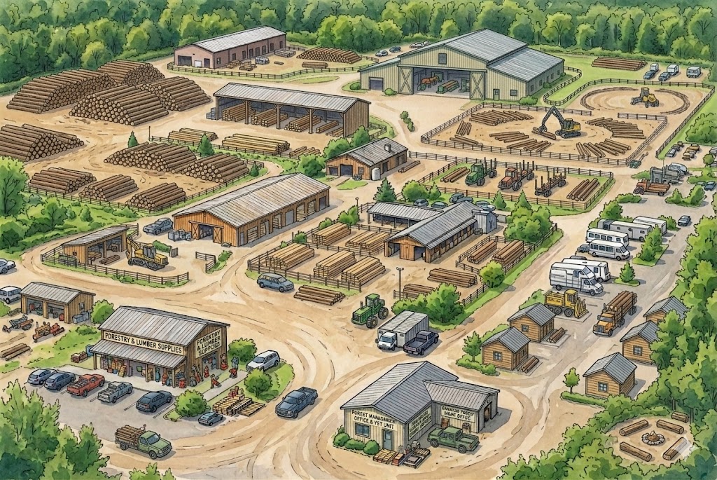
Rendering of forestry cluster
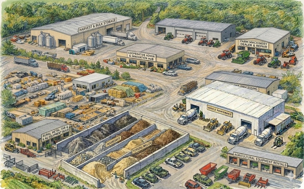
Rendering of rural industrial and aggregate cluster
CLUSTER 06
Rural Industrial & Aggregate
Rural industrial and aggregate uses require space and operating conditions suited to rural lands, and are explicitly supported in the CVRD’s OCP.
- Quarrying and storage
- Redi-mix concrete plants
- Soil and mulch production
- Composting facilities
- Gravel and aggregate sales
- Light and heavy industrial
- Equipment rental and repair
- Outdoor and self storage
- Manufacturing
- Warehousing
- Wholesale / retail supply
- Contractor yards
- Industrial offices
CLUSTER 07
Attainable Workforce Housing
Housing is not a primary focus for these lands, but the OCP supports a limited amount of workforce housing to support the rural economy.
- Company workforce housing
- Seasonal worker housing
- Modular / pre-manufactured
- Accessory caretaker housing
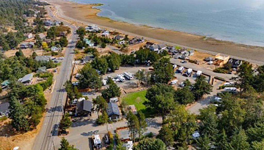
Workforce housing at Cape Lazo RV Park
COMMUNITY BENEFITS
A network of public and protected lands.
A range of community benefits will be associated with the proposed project, including a significant designation of lands for public use and/or protection, including the rivers, much of their edges, and key environmental, archaeological and culturally significant areas. This land contribution supports a minimum lot size of 4 ha/10 acres which is a good size for appropriate employment density for the area.
PROJECT TEAM
The people behind the proposal.
The Puntledge proposal is being led by a small group of people with deep personal ties to Vancouver Island who share a belief that rural development can be approached thoughtfully, responsibly, and in alignment with the long-term interests of the community. Their objective is to help create a project that reflects the unique environmental, cultural, and economic context of the Comox Valley while preserving the qualities that make the area special.
LANDOWNER REPRESENTATIVE
Andrew Mallory
Valiant Group of Companies
Andrew and the broader ownership group have deep roots in coastal British Columbia and a longstanding connection to the communities, landscapes, and industries that have shaped Vancouver Island. Their approach is guided by a belief that thoughtful growth should respect the natural environment, support local employment, expand recreational opportunities, and create lasting value for the people who live here. Andrew has been closely involved in shaping the long-term vision for the lands, working alongside the ownership group to keep the project aligned with its core commitments: environmental stewardship, conservation, recreation, and sustainable rural economic development — and the lasting benefit of both the surrounding community and the generations to follow.
ProJECT LEAD
Leon Teplitsky
Valiant Group of Companies
Leon has been leading the day-to-day advancement of the Puntledge Project as Development Lead. With family ties and longstanding personal connections to the Comox Valley, Leon has been heavily involved in coordinating the rezoning strategy, consultant team, stakeholder engagement, and long-term planning framework for the site. Since taking over the project, his focus has been on rebuilding trust, aligning the proposal with the Official Community Plan and Regional Growth Strategy, and moving the lands toward a vision that balances employment opportunities, environmental protection, recreation, and community benefit.
PROJECT CONSUlTANTS
Westplan Consulting
Group
Community Planning
Strathcona Forestry Consulting
Forestry Consultant
Corvidae
Environmental Group
Environmental Consultant
GW
Solutions
Hydrology Consultant
McElhanney
Consulting
Engineering Consultant
Newcastle
Engineering
Engineering Consultant
Ryzuk
Geotechnical
Geotechnical
KFN
Archaeology
In Situ Archaeology
FAQ’s
Frequently asked questions.
PRocess & Next steps
The vision for Puntledge is in the early stages.
Bringing this proposal from rezoning application to a built project will take years as work moves through four overlapping stages — each with its own approvals, decision points, and opportunities for community input. The sections below outline what to expect at each stage and when.
Rezoning Approvals
EStimated TIMING:
2026-2027
A rezoning application will be submitted in spring 2026 and begin a process of review by the regional district, community engagement, and refinement of the application. That process will ultimately lead to the application coming before the CVRD Board for its decision.
Subdivision & Servicing
estimated TIMING:
STARTS in 2027
Following the rezoning, sections of the site will begin to be subdivided (a phased process). Roads and infrastructure will need to be installed as each cluster of lots are created in a series of sequential subdivisions. This process will move forward as fast as the market demand for lots allows.
Project Approvals
(Individual Lots)
estimated TIMING:
2028
Owners of the future parcels will decide what they want to build and they will undertake the design and approvals for their projects.
Construction
Process
estimated TIMING:
2027-2028
Construction of the first roads and infrastructure are likely in 2027-2028. Construction of buildings on any lot is unknown, as that will be led by the future owners of the parcels.
STAY CONNECTED
Share feedback, ask questions & stay informed.
Community input is an important part of the planning process for this site. Use the form below to share questions, comments, or ideas about the proposal — whether about a specific land use cluster, the overall vision, environmental and cultural considerations, or the engagement process itself.